


Poonch is a border district of Jammu & Kashmir located in the Pir Panjal sub division of Jammu province. It is popularly known as Mini Kashmir & the valley of seven lakes.
J&K Weather
Poonch Area: The total area of the district is 1,674sq.km. Out Of this 83,914 acres are forests. In addition, there are 2,497 hectares of orchards. The district is mostly mountainous. Poonch town, at 3,300′, is in the low hills, though.
Poonch Population: As per the census of 2011, the total population of Poonch district is 476835, out of which Rural: 438205 & Urban: 038630.

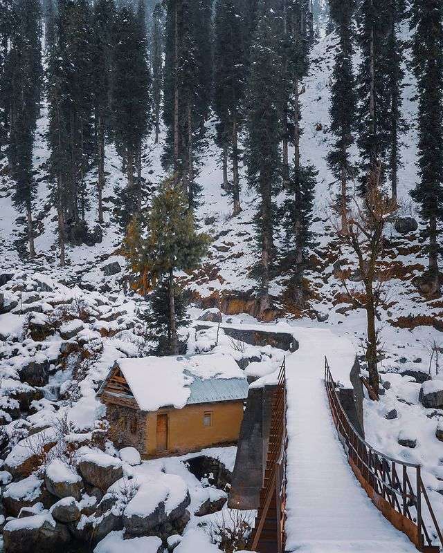
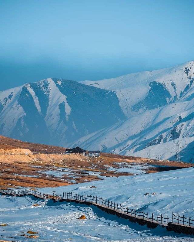
Poonch in Winters
Villages: There are 179 villages in the district, of which 10 are uninhabited. All the inhabited villages have electricity and potable water. Poonch proper, Surankote & Mendhar Proper are the district’s only town.
Administrative divisions: The district is divided into four tehsils, viz. Haveli, Poonch, Mendhar and Surankot. It has following ‘blocks’ for the purposes of rural development, namely, Balakote, Mandi, Poonch, Mendhar, Surankote, Buffliaz, Lassana, Sathra, Mankote, Nangali Sahab & Loran.
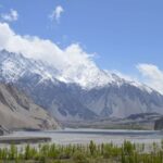
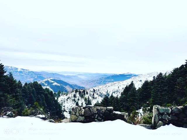
Climate: The climate depends on the altitude of the place. Poonch proper is colder than Jammu or Delhi but not as much as, say, Srinagar. However, the higher mountains can be very cold. The climate of Poonch is much resembles with Kashmir valley . Poonch has intermediate to cold temperate type climate in the middle & Northern parts. It has subtropical type climate in the southern parts especially near Mendhar & Mankote block lower valleys, which trends to temperate towards North & top mountains of these two blocks. The higher reaches of district Poonch are much colder climate than Kashmir Valley & the higher peaks of Pir Panjal remains covered with snow over the most part of the year. Except the parts of Mendhar & Mankote block whole of the Poonch district recieves snowfall during winter season under the influence of western disturbance.
Main crops: Maize, paddy and wheat. Chikri, a rare tree, is grown in the cold & shady areas of the district. Anardana (pomegranate seed) and cotton grow Apricots and pears grow in other parts.
Minerals: There are iron mines in Mandi and (Bagh now in POK ).
Geography
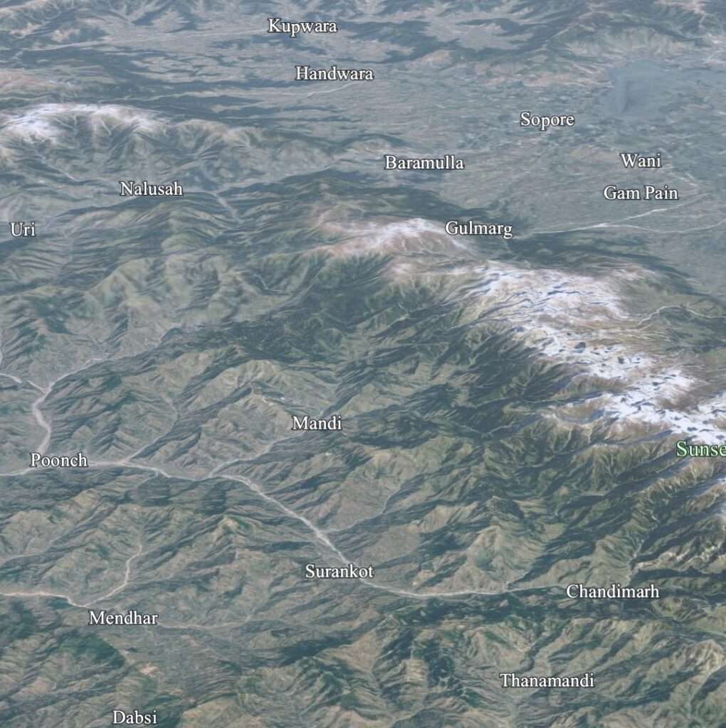
Poonch share it’s border with Pakistan in the west . Rajouri in the south and Baramulla & Budgam in the north-east , Kulgam & Shopian district lies in the East . The only way to travel to Poonch is by road: by bus or taxi from Jammu city or Srinagar. Buses leave Jammu’s main bus terminus early in the morning. Tata Sumos are slightly more expensive than buses but are considerably faster and a more flexible option. From Srinagar Mughal road is the best route to reach the Poonch
Language Spoken
Most of the population of the district speak Pahari as their native language, the speaker of this language are known as Pahari (Pahadi Tribe) . Gojri is the second most spoken language of the district which is spoken by Gujjar & Bakerwal Tribe.
Folk songs
As in other languages, Punchhi folk songs normally revolve around love: men pining for women. They are also about famous battles and family feuds. Wedding songs are a significant genre. Apparently the songs are also about “social rituals, social evils and superstitions. Chann [the beloved], Kainchi, Sepaiah [the policeman] and Maaiah are some of the popular folk songs [genres] of [Gojri and Punchhi],” a government publication informs us. It adds, “Folk songs about fairs, festivals and seasons are always of [sic] shepherds and rustics. Folk ballads which are part of folk songs, speak of the bravery and heroism of the people of Poonch. Some folk ballads i.e. Jabtu, Shamash [sic] Khan and Nura still resound in mountains of the area.
Important places of tourist interest
Bafliaz: (Also spelt Buffliaz.) 39km. east of Poonch town. Apparently the village has been named after Bunifales, the horse of Alexander the Great, which died here. It’s a very pretty village in the foothills of the Peer Rattan range, and has been built on both banks of the Poonch river. It is the base camp for several treks.

Battalkote: Battalkote is the last populated village in the Peer Panchal mountain range. This isolation, coupled with its meadows, adds to the charms of the village. The Nain Sukh nallah (stream) meets the Nandi Chhool / Nandi Shool nallah nearby. There are tall mountains, often covered with snow, and forests not far from here.
The village was originally called Bhatta Kote (‘the town of the Kashmiri Pandits). The Tosha Maidan Road starts here. It leads to the Noorpur pa (13,610). Huen-Tsang, the Chinese traveller, mentions this village as being famous for its iron mines.


The army of Sultan Mehmood of Ghazna surrounded and laid siege to Loran (then Lohar Kote) in A.D. 1021. The Sultan then tried to launch an attack on Kashmir. The Kashmiri army that successfully fought the Sultan got its weapons made at Battalkote, because of its tradition of iron ware.
Behram Galla: This village is about 45km. away from Poonch town, was known as Bharo Gali. That’s roughly the name by which the Rajatarangini refers to it. It got its present name after Behram Naik, the local jagirdar (overlord).
The year 1542 looms large in the history of this village. That was the year when the Mughal Emperor Akbar used it as the base camp for his invasion of Kashmir. It retained this position for a long time thereafter. several battles were fought here. The ruins of Behram Naik’s stone fort are testimony to the village’s bloody past.
The village is at the feet of the 8,600′ Rattan Peak. It is a flat land, a deep gorge to wit, surrounded by forests and tall peaks. Trekking routes lead out of the village to these peaks. The trek to Girjan/ Girgan the valley of seven lakes, is the most rewarding of the lot. There are two shrines, one each Hindu and Muslim, in the village.
BehramGallâ: It has been mentioned in The Râjâtarangini as Bharogal, after Bhairon, a Hiñdû deity. The township was briefly, around A.D. 1420, a military cantonment and its surrounding areas a battle ground for rival Kashmîrî armies. Sultân Ali Shâh and his soldiers camped here while his brother Shahrukh Khân (later Emperor Budshâh) stationed his forces at Thanna Mandi.
ChandiMarh:Chandimarh has for centuries been known for the manufacture of implements made of iron. This little town is close to Behram Galla. In the nineteenth and early twentieth centuries it was, according to British travellers, a little town made up of log-houses. There are deodars and chestnut trees, as well as the only-slightly-less-majestic pine trees on the hills, some of which rise straight from the river.
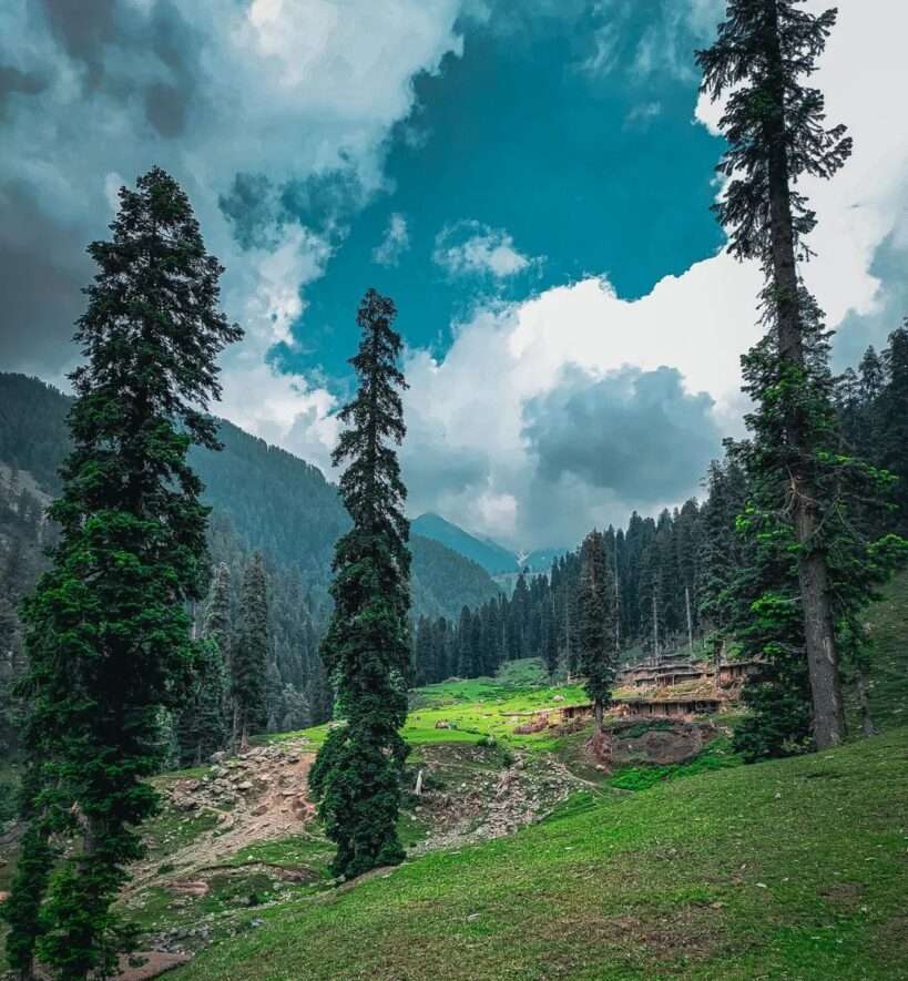
In spring, summer and early autumn shepherds of various communities take their sheep and horses to pastures in the higher mountains.
Gagrian Sawjian: It is 45km away from Poonch, in the Mandi valley, at the foothills of the Chor Panjal pass, is this wooded base camp for trekkers.
Beyond the pass are Khilanmarg, Gulmarg and Tangmarg, all in Kashmir.

Girjan (Also spelt Girgan.): It is about 70km away from Poonch, located in Surankote teshil of the district. This is the fabled valley of seven mountain lakes, including the Neel Sar, Katora Sar and Nandan. It is a trekkers’ paradise because of the variety of treks in the area.
Presently there is no Road connectivity at this site.
Krishna Ghati: 24km. from Poonch town on a fairly good road. This is a hilltop with a vantage view of the surrounding forests and other secnic beauty.
Loran: It is about 34km north of Poonch town. Loran, then known as Lohar Kote, was the capital of the Poonch area till 1542. Loran’s legendary fort, now in ruins, was said to be impregnable. Raja Trilochan Pal of Loran defeated Sultan Mahmood of Ghazna at this fort.
There are tall mountains of the Peer Panchal range, as well as forests, around this picturesque town. The Mandichool waterfall is 7km. from Loran. The shrines of Hazrat Chandan Shah and Sâîñ Ilahi Baksh, too, are nearby.
The Mughal Road: This is the alternative road of Kashmir valley which connects Poonch district with South Kashmir Shopian district. The Mughal road originated at the Mughal capital, Agra (in central India). It wound its way through Lahore (now in Pakistan) to Poonch, Rajouri and, thence, to Srinagar in the Valley. It’s a pity that relations between India and Pakistan are what they are, because it would be so rewarding to recreate the Mughals’ journey and see the wonderful buildings, forts, tombs and sarais (rest-houses) that they had got built along the route.
The Poonch segment of the road used to be called the Namak road (presumably, the ‘salt road’) till Jehangir (early 17th century) travelled on it and renamed it the Mughal Road.
Nandi Chhool: 13km. from Loran town along a ‘jeepable’ track. This is a major-and picturesque-waterfall located in Loran valley of Mandi tehsil. Gulmarg (in Kashmir) is on the other side of the same hill. Except that it is quite far from the nearest major town (Jammu), Nandi Chhool could be one of the important tourist attractions of the state.

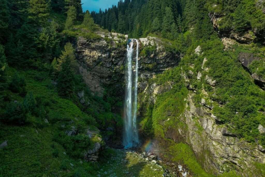
Noori Chham(b): (45km. east of Poonch.) This celebrated waterfall is located in the Panjsarain valley in Surankote. It is close to and north east of Behram Galla . It is said that the fall used to be 90 metres high. It has been eroded considerably over the centuries. Even today the spray and mist created by the fall would rank it among the most beautiful anywhere.

The other toursit sites of the district Poonch are Dehra Ki Gali, Jabbi Toti, Dhanna Shastar, Nurpur dhok, Sultan Pathri, Oosi dhok, Chamrer Gali, Peer ki Gali & Sari Mastan
Other important information

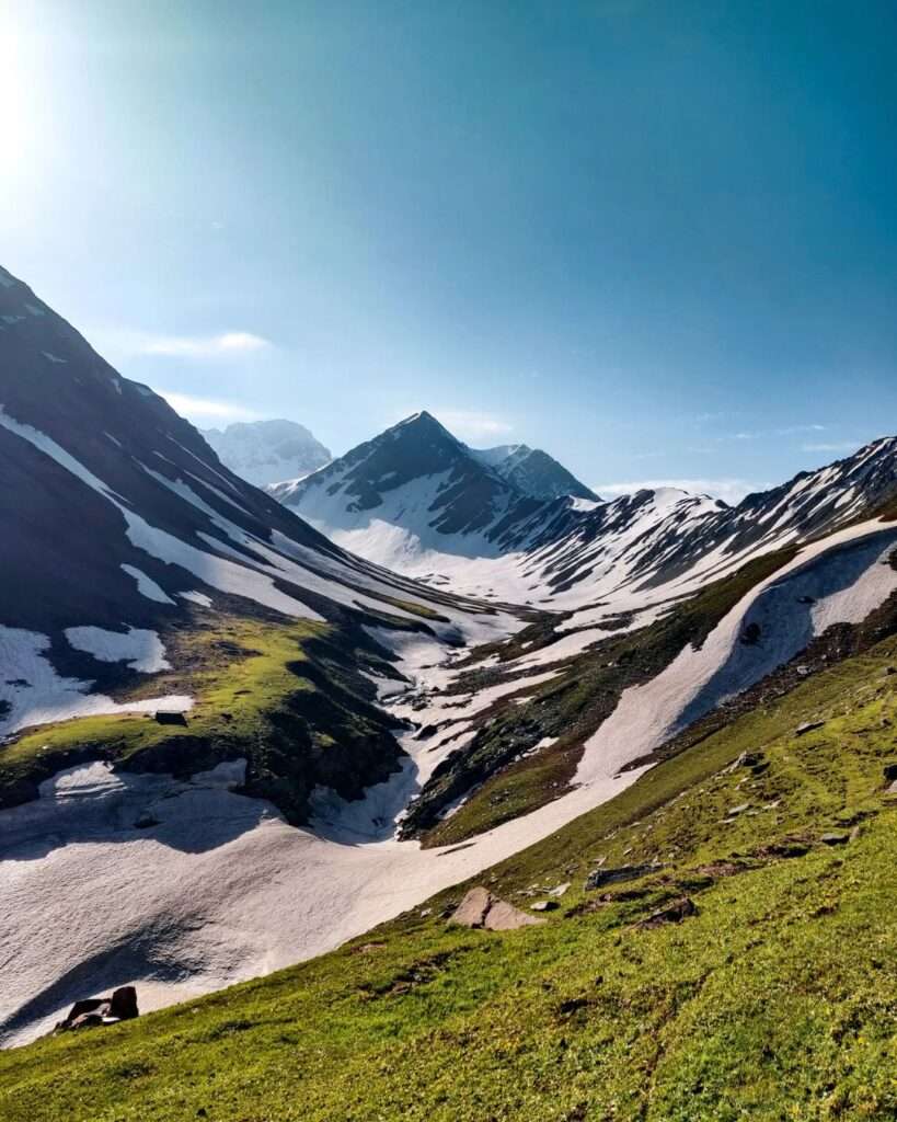
Tatakooti Peak: It is the highest peak of district poonch located in Surankote tehsil of district . The elevation of this peak is 4765M


Tatakooti Mountain
J&K Weather
Peoples also search for.
Jammu to Poonch distance, Jammu to Mendhar distance, Jammu to Surankote distance, Poonch News, mendhar News, Surankote news